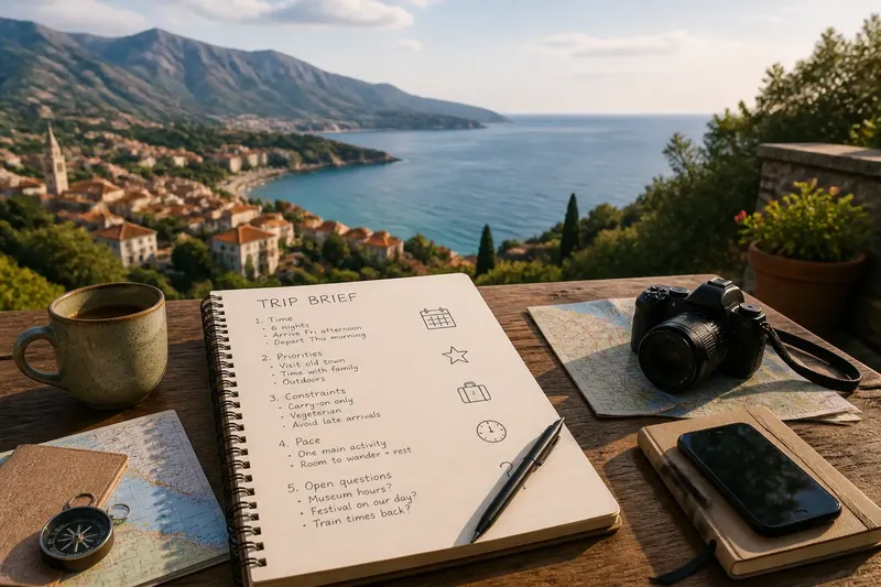
Why Old Towns Often Feel Like a Maze
Old town navigation gets easier when you read street patterns, signs and landmarks together, so you can choose a route that suits the place and your plans.
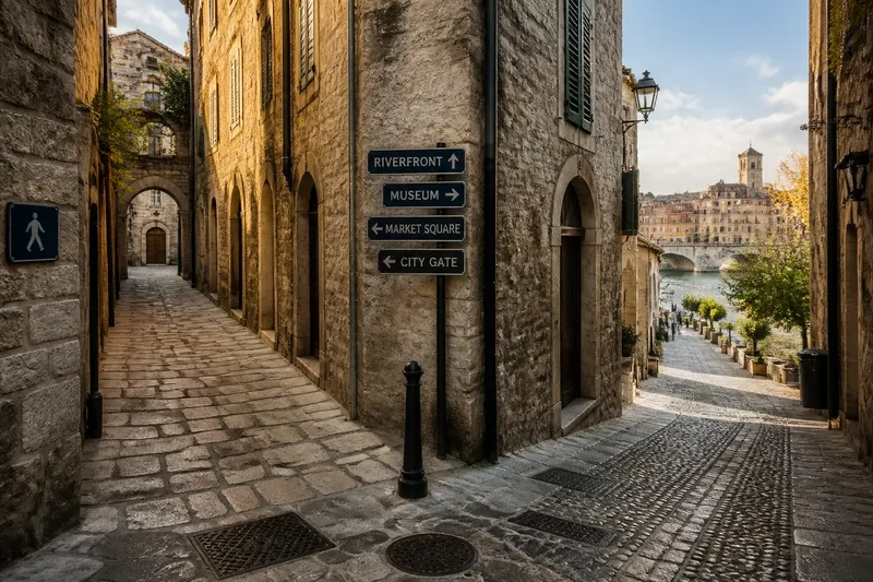
Old town navigation works better when you read street signs and junctions than when you try to impose a modern grid on the streets. A lane may curve around an old wall, climb towards a church or emerge at a market square, so check each turn against what is actually in front of you.
Historic centres differ: some have tightly packed lanes, while others are organised around a broad street, riverfront or central square. Before setting off, identify the type of layout and decide whether you need a direct route, a step-free path or time to explore.
Why does old town navigation feel confusing?
In a grid, you can often predict where streets meet. In older centres, junctions may be uneven, routes may bend or double back, and lanes can change direction around buildings and property boundaries.
Street width does not always tell you which way to go. A narrow passage may be a public thoroughfare, while a broad street can curve away from your destination. Slopes, steps, arcades and courtyards also affect how a route feels on foot.
Landmarks are useful, but they are not a complete navigation system. A tower can disappear behind buildings, and a church entrance may face a square rather than the street that appears to lead towards it. Check the next junction on a map or sign when your view changes.
Which navigation method should you use?
Choose between turn-by-turn directions, landmark orientation and a route guided by street signs and local layout. Your destination, access needs and familiarity with the centre should determine the method.
When are turn-by-turn directions useful?
Use a map when you have a timed booking, need to reach a specific entrance or are unfamiliar with the area. Save the destination for offline use if your map allows it, then compare the suggested route with signs and visible street names as you walk.
A mapped line may not show whether a passage is closed, private or unsuitable for your access needs. Check current signs and information from the venue or local authority where access conditions matter.
When do landmarks help most?
Landmarks work well when you can clearly identify a distinctive feature, such as a waterfront, city gate or market hall. Use it to keep a general sense of direction, then confirm street names at junctions.
This method is less dependable when buildings block the view or several towers look alike. Confirm the landmark’s name on a map before relying on it; otherwise, you could head towards the wrong feature.
Can street signs guide you through an old centre?
Street signs can confirm your position even when a lane turns unexpectedly. Look for signs on building corners, at junctions and near public squares, and compare the name with your map before taking an unfamiliar turn.
Some signs may be missing, hard to see or displayed in a language you do not read. In that case, use a saved map or ask at a staffed public venue rather than guessing from the street’s appearance.
What should you check before choosing a route?
Match the route to the conditions you can verify before you leave. For each item, check the observation and follow the decision it points to:
- Timed destination: Check your booking time and the address or entrance. If arrival time is fixed, choose a route you can follow turn by turn; if it is flexible, allow time to confirm junctions on foot.
- Steps or steep streets: Check map details and current access information. If the route includes obstacles you cannot use, choose a confirmed alternative; if access details are unclear, ask the venue or local authority.
- Street-name signs: Check whether signs are visible at the junctions on your route. If names are clear, use them to confirm turns; if not, keep the map available and avoid relying on memory alone.
- Landmark visibility: Check whether a distinctive feature can be seen from the streets you plan to use. If it is visible and identifiable, use it for general orientation; if buildings obscure it, follow street names or map directions.
- Passage status: Check signs for closures, private access or restricted entry. If the passage is open to the public, continue; if it is closed or access is uncertain, return to a public street and check another route.
- Return direction: Check the name of the street or square you will use to retrace your route. If it is clearly marked, note it before wandering; if not, save a map pin and use it to locate your way back.
Say you are walking to a riverside museum in a compact old quarter. Your starting point is a market square, your saved map shows a lane to the museum, and a sign at the first junction says that lane is closed. Check the map for a public street leading towards the river, confirm its name on a sign, and follow it to the museum entrance; the trade-off is a less direct walk, while the observable result is a route that avoids the closed lane and uses named streets you can retrace.
What should you do if you lose your bearings?
Stop somewhere that does not block other people and identify the last junction or landmark you recognise. Check its street name against your map, then choose a direction from that confirmed point instead of walking on in the hope that the next corner will make things clearer.
If you reach a closed passage or an unsuitable stretch, turn back to the last clear junction. Choose a public street with visible signs, even if it is not the shortest line on the map. If signs and map details conflict, check current local information or ask staff at a nearby public venue.
Old town navigation is easier when you treat each junction as a fresh check rather than expecting the street pattern to behave predictably. Keep your map available, use signs to confirm turns and rely on landmarks only when you can identify them clearly. Before leaving a square or main street, note its name; that simple detail gives you a practical reference if you need to retrace your route.